Mountains in Northern Ontario – Our Peaks
by Back Roads Bill
 Not often but sometimes we carefully climb to the top of our roof to check the chimney, the shingles, the whirligig, the satellite dish and to secure Santa and the elves.
There is something more special when you climb to the top of a mountain and you experience the 360° view. It includes the process of getting there.
Measuring mountains might not seem overly complicated, but there actually are several ways in which it can be done. Depending on which technique is used, the title of world’s tallest mountain could go to any of several mountains in various regions of the world. Some scientists heatedly debate the issue, arguing that their technique is the most accurate. The world’s tallest mountain differs depending on whether a mountain’s height is measured from sea level, by vertical rise or from the base or even from the center of the Earth. This clouds the debate in northern Ontario as well; what height of land claims the title for us?
Mount Everest is called the world’s highest mountain because it has the highest elevation above sea level. We could also say that it has the “highest altitude”. Mount Everest – China/Nepal – 8850 m (29,035’). From base (from the ocean floor) to peak it is the volcano, Mauna Kea in Hawaii. Low humidity and clear skies make the weather conditions near the volcano’s summit nearly perfect for many of the world’s leading space observatories.
However, the problem with choosing one of the techniques is the dividing line between a mountain range, like the Himalayas, with multiple peaks, and a separate mountain; it is not always clear. For this reason a better measurement to use is called “topographic prominence” (basically how much the mountain sticks out from the surrounding landscape and this is more applicable to northern Ontario).
Northern Ontario Mountains
Most of us won’t conquer a lofty peak but we can climb the highest peaks in Ontario most are accessible though our land and water back roads.
Larry Dyke, is a Professor Emeritus, from Queen’s University, Department of Geology and has retired to the Talon Lake area. He told Community Voices, “Most of the Canadian Shield must have once been mountainous. The highly metamorphosed nature of Canadian Shield rocks could only be produced by heat and pressure. To have these kinds of rock now exposed means that they were brought to the surface by a combination of uplift and erosion. The Selkirk Mountains in British Columbia started undergoing this process about 70 million years ago, so that when they are eroded in the distant future, they will look much like the Shield does today.”
“In northern Ontario the same thing started about 1,200 million years ago. We now see the roots of these ancient mountains, exposed and subdued by erosion acting over that enormous length of time. Glaciations that repeatedly covered most of Canada over the last 2 million years are just the last stages in the long erosional history. Ishpatina Ridge and Maple Mountain today stand prominent. Particularly hard parts of this accumulation have resisted the ice scouring and remain as these Ontario high points.”
Our northern Ontario highest peaks are older, worn mountains then, easy enough to understand.
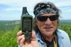
Ishpatina Ridge is the highest point of land in Ontario, at an estimated 693 m (2,274’) above sea level. It rises approximately 300 m  (984’) above the immediate area. The name “Ishpatina” comes from an Ojibwa language word ishpadina, meaning “be a high hill/ridge”. Spadina Avenue in Toronto is derived from the same word;( there is a height of land in the Queen’s Park area). The ridge lies within Lady Evelyn-Smoothwater Provincial Park.
It is often mistaken as being the highest mountain in Ontario, however Maple Mountain is actually lower on the list, but has the highest vertical rise in the province; 351 m (1,152’) on the landscape. It is also within the park’s boundaries. Temagami First Nation refer to the mountain as Chee-bay-jing, which means “the place where the spirits live” and is considered a sacred site. The mountain was named by Dr. Robert Bell of the Geological Survey of Canada in 1888. Bell was the first known non-aboriginal to reach the summit.
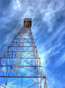
There are abandoned Lands and Forests (now MNR) fire towers on both peaks and the views are expansive, almost pure wilderness.
Summit Directions
A phalanx of people has climbed Mount Kilimanjaro, Africa’s highest peak. It is dismissively known as the “Coca Cola route.” It has comfortable huts for tourists to sleep in, food and drink is for sale and the paths are thronged with climbers. Not in northern Ontario though, some effort is required to reach the top of the two nearby peaks.
To reach the Ispathina Ridge, which can be done in one “long day,” journey west to Sudbury and travel north to Capreol. Topo. (NAD 27) maps 041I10 (CAPREOL),041I15 (MILNET),041P02 (PILGRIM CREEK), 041P07 (SMOOTHWATER LAKE) will help.
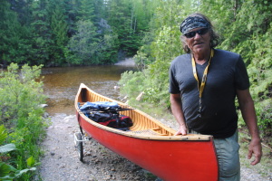
Cross the tracks in Capreol, turn on to Sellwood Ave., which becomes Regional Rd. 84 and drive northwards out of town to Portelance.Rd,(Gauthier Lumber Rd.) .turn right or east; it is about 65 km to the Sturgeon River. On the way you will cross the Wanapetei River from the west to the east side; follow the river northwards; nice scenery with many rapids all the way to the key turn at Stobie Rd – NE or right, then north or left on Gervais Rd. It is north (any left turns) all the way to the Sturgeon River. You will park  at the gated bridge. A canoe trailer will help. It is an easy 4.5 km walk along the logging road to Little Scarecrow Lk.; about 90 minutes to two hours. Put in at Hamlow Lk. and paddle up to Little Scarecrow Lk. Push or drag the canoe upstream through two shallow rapids; then a 50 m portage uphill at the south end of Woods Lk. It is about ninety minutes from Little Scarecrow Lk. to the trailhead. The trail has one wet section and entire route is well marked. The summit is WGS 84 Zone 17 T E518669 N5240506 or N47° 19’ 03.9” W80° 45’ 10.7”. There is a good island campsite on Scarecrow.Lk. You can also bushwhack to the summit from your car, without a canoe, Google: Ispathina Ridge Overland.
Maple Mountain is NE of the Ispathina Ridge, about 32 km. (WGS 84 17 T E549998 N5249380 or N47° 23’ 45.5’ W80° 20’ 14.8”. It can be reached via a 3.3 km long hiking trail from the trail head on Tupper Lake; (it is a longer and steeper trail than the one to Ispathina). At Haileybury turn west from Highway 11 on to Highway 558 to Mowat Landing. You will launch and then quickly cross the hydro dam on the Montreal River. Topo. map 031M05 (COBALT);041P08 (LADY EVELYN LAKE) will help. You will travel SW all the way across Lady Evelyn Lk. (watch for the fetch). Then westwards to Sucker Gut Lake. You will find the channel (one portage past a short set of rapids) that turns north to Hobart Lk. (campsites) and then to the far end of Tupper Lk. where the ascent begins.
[The highest mountain in Canada Mount Logan is still rising in height. Before 1992, the exact elevation of Mount Logan was unknown and measurements ranged from 5,959 metres (19,551 ft) to 6,050 metres (19,849 ft). In May 1992, a GSC expedition climbed Mount Logan and fixed the current height of 5,959 metres (19,551 ft) using GPS. Dundalk, just south of Collingwood, has the highest elevation in Southern Ontario (south of Algonquin Park) at 526 m (1,735 feet).]
These accessible northern Ontario peaks are higher than your roof and the view is better. (And this year it seems there are few, except for the Griswolds, climbing on to their roofs to festoon decorations to the chimney or the whirligig; a real shortage of elves, Santa and reindeer beyond the eaves trough.)
GPD File